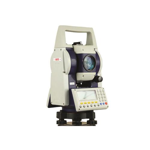
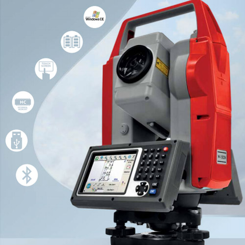
Total Stations Philippines
Total stations in the Philippines are commonly used in surveying, construction, and mapping.
A total station is an optical or electronic tool used in latest modern building construction and surveying that uses automatic transit theodolite in conjunction with EDM or electronic distance meter. It is also attached with electronic data collector, microprocessor and storage system.
The tool is applied to calculate sloping space of object to the tool, vertical angles and horizontal positions. This microprocessor unit permits for computation data gathered to additional measure the horizontal space, coordinates of a dot and decreased level of point.
Data collected from total station can be downloaded into notebooks or computer for additional processing of information.
Total stations such as Pentax total stations are largely used by civil engineers and land surveyors, either to record specs as in topographic surveying or to set out specs (such as houses, roads or boundaries). They are also used by archaeologists to record excavations, private accident reconstructionist, crime scene investigators, and insurance firms to take dimensions of scenes.
Total Stations for Sale

Uses of Total Station
Measures Distance
Some total stations contain not just a conventional infrared distancer that calculates to prisms, but also an integrated laser distancer that needs no reflector, providing you the capability to switch between these 2 options.
Reflectorless distance measurement is mainly helpful in conditions where levels are hard or not possible to get – when locating pipes or calculating across gorges or fences, for example. Some systems have a co-axial detectable red laser dot that can be used to mark focus in link with the recording of indoor work or tunnel profiles.
Aims Target
Total stations that are furnished with a mechanical target aiming system make targeting simpler and quicker. All you have to perform is to point the telescope at the reflector and push a key that then mechanically trigger the fine angle, pointing, and distance measurements, and records all of the values.
This special technology makes it easy to carry out completely mechanical measurements. After establishing primary contact with the target.
Measures Angles
An angle shows the difference between 2 directions. Under perfect situations, the horizontal angle between the 2 directions leading to the P1 and P2 is independent of the height difference between these points, offered the telescope forever moves in a seriously vertical plane when titled, no issue what its horizontal orientation.
The vertical angle (also known as the zenith angle) is the difference between an agreed direction and the direction to the point under consideration.
Plots Coordinates
Explaining the position of a point needs 2 coordinates. Polar coordinates need an angle and a line. Cartesian coordinates require 2 lines within a coordinate orthogonal structure.
The total station calculates polar coordinates, after that recalculated as cartesian coordinates within the offered orthogonal system.
Construction industry use total station for center line marketing, demarcation of boundaries, reverse engineering and heavy engineering uses total station to get as built data. Total station efficiency has been improved from mm to micron nowadays. This latest surveying tool can also be managed remotely which can get rid of the need of extra workers and so decrease the cost of a survey to the consumer.
Advantages of Total Stations
- With the application of laser plummets, the setting of the tool on the tripod can be done fast.
- On-board area computation permits the users to work out the area of the field.
- Computerization of old maps
- Well matched with domestic language
- Calculation for area can be done more precisely
- Incorporates database
- Graphical view of land and plots quickly
- Full GIS formation
- Once the field jobs are done, the map of the area with dimensions is prepared after transmission of data
- It saves big time. It can calculate up to three to five km distance
- The calculation can be made as per the needs of the users.
Disadvantages of Total Stations
- At the time of surveying or mapping, it becomes hard for the surveyor to watch and check the work.
- To evaluate the survey fully, it is very important to get back to the office and produce the drawings with right program.
- The instrument is costly. The competent persons are needed to operate the surveys with total stations.
- Protect the battery pack with the battery discharged
- In order to grip the total station handle, both hands should be used.
- Maintain adequate consistency to install the tripod
- It is advised not to carry a tripod with the total station fixed on it, rather than centering
- Take right safety measure at the time of extracting the tribrach of the device
How Does a Total Station Work
It is an automatic theodolite gathered with an automatic distance meter that has a further inside data storage or outside data collector. It works by calculating distance coordinates, measuring angles, and heights. The data is moved to a computer that uses a program to produce a map of the area.
The device produces a laser beam on a focus and notices the light mirror back. The station measures the real difference of the reflected lights wavelength. It has a correctness of 0.07 inch per 0.62 mile. Direct line of sight is needed to measure the coordinates of an unknown point corresponding to a famous coordinate. Some total stations uses Global Navigation system receiver to bypass the line of sight need. GNSS provides a bad accuracy on vertical axis and needs longer period of time to take the measurement.
Components of a Total Station
A total station is made up of 4 main components: Electronic distance measurement (EDM), electronic display, microprocessor, and electronic theodolite.
It can be classified according to the wavelength used: microwave or electro-optical (laser or infrared). The temperament of the reflector is work on the form of electromagnetic used. A passive medium (prism) is applied with automatic-optical electromagnetic but if microwave is applied, then a second transmitter or receiver is needed.
1. Electronic distance measurement (EDM)
EDM is a major component of a total station. It measures distance ranging from 2.8 km to 4.3 km. It is accurate up to 10 mm per kilometer of measurement. It is used with mechanical target recognisers. The distance measured is the sloping distance from the total station to the object.
2. Electronic display
Automatic display device is capable of presenting different values when special keys are pressed. The system is able of showing horizontal distance, horizontal, vertical positions, difference in heights of 2 experimental points and all the 3 coordinates of the practical points.
3. Microprocessor
The station features an inherent microprocessor. The microprocessor calculates different scenarios. It plots the X, Y, Z coordinates and calculates the distance. it can adjust calculation to take into consideration pressures and temperature as long as these information are provided.
4. Theodolite
The automatic thedolite part of total station is used for horizontal and vertical angle. For measurement of horizontal angles, any suitable direction may be taken as a reference point. For vertical position measurement, vertical upward method is followed as reference point. The correctness of angle measurement varies from two to six seconds.
Each data point can be saved in an electronic note book. The ability of automatic note book changes from two-hundred points to four-thousand data points. Inspector can unload the data saved in notebook to PC and use the note book again.
How to Use a Total Station
- Set up the tripod as stable as easy
- Use both hands to grip the total station handle
- Do not carry or move a tripod with the total station fixed on it, except for centering
- Do not over tense any of the clamp screws
- Save the battery pack with the battery discharged
- Take utmost care when the tripod is removed from the total station.
How to Setup a Total Station
Your total station is an accuracy tool, but it just does what you tell it to. Right measurements begin with best setup. Begin with a known point, then enter the station orientation and coordinates, and you will be ready to calculate your next job. For a more precise measuring procedures and guide, check your total station’s user’s manual.
This is an easy and simple guide on how to set up your total station. Following this process is the fastest way to set up your total station.
- Spread the trip legs equally.
- Spread the legs in a triangular position.
- Confirm the tripod top is on the right level.
- Lift the full tripod and locate it above the nail.
- Stand back and confirm that nail is lined with the middle of the tripod head from all areas.
- Grip the screw setting up vertically and at the middle of the tripod top and look it to ensure it is centered over the spike.
- Make sure that the tripod top is level.
- Stamp the feet of the tripod strongly into the ground. Check that it is still centered over the nail.
- Take the device out of the box and link it to the tripod head.
- Looking via the optical plummet, adjust the foot screws until the back circle is centered over the nail.
- Manage the distance end to end of two of the legs until the rounded bubble is centered.
- Repeat steps nine and ten as lots of times as important until the nail is centered and circular bubble is centered in right place.
- On the other hand, when the rounded bubble is on the middle position and you are pretty near to the nail, relax the fixing screen and slide the device over the top of the tripod until positioned at right place.
- Turn around the lengthy bubble until it is parallel to 2 of the foots crews. Call them 1 and 2.
- Rotate 1 and 2 in counter ways until the bubble is located in middle area.
- Turn through ninety degrees.
- Use foot screw 3 on its to center the lengthy bubble
- Turn through ninety degrees.
- Rotate A and B in counter directions until the bubble is located in the middle area.
- Use C foot screw on its own to middle the long bubble.
- Turn through ninety degrees, back to the beginning position. The long bubble should be centered. If not repeat from step eighteen.
- Look via the optical plummet to check that you are still centered over the nail.
- Resection helps you compute the height and position of your local station, as well as direction of the horizontal ring, based on the measurements to 2 or more points with known coordinates. You can go into these coordinates physically, or you can save them in the device beforehand. The benefit of resection is that it permits you to pick the top position for the total station before you stake out or survey.
Difference Between GPS and Total Station
GPS stands for Global Positioning System. It is a set of number of satellites in the space sending the right location details in the area back to Earth. Signals are got by the GPS tool which used to calculate its place time, speed, height of the place and other info.
It is very famous in the army globe and was initially developed by the USA army during the Cold war era. It was primarily used for ship navigation by USA navy during the 1960s. GPS technology was made accessible to the public during the 1980s.
- Used for navigation
- Requires a big infrastructure – precise time gadgets, satellites, radio communication centers, and satellite control centers
- Range is the full globe
- Accuracy levels measured in the meters
- The infrastructure is very costly
- The user gadget is extremely inexpensive (chips accessible on the order of a few dollars or less).
- Requires extremely skilled workers to use and expertise to maintain infrastructure
TOTAL STATION
Total station does not know where it is beginning from unless you give it detail, like beginning from a known surveyed point or benchmark. Total stations can have right levels measured to less than a millimeter.
- Used for volumetric, surveying dimensions (such as stockpiles), crash site examinations, and so on.
- Measurements from a central point (where the station is placed)
- Few can measure sub-millimeter accuracies
- Range calculated in the kilometer size
- Requires vital expertise set to use the system, take and analyze data perfectly, and generate outputs, maps, and so on.
- Standalone – that is, it can perform its measurements without big infrastructure, satellite, outside tools, and other elements.
- The user device is costly
Price of Total Station in the Philippines
Software compatibility is the big driving factor when picking a total station. While some total stations come equipped with internal automatic data storage, most models are designed to write measurement to an outside data collector such as handheld PC.
When using an external data collector, application program is needed to calculate the outcomes and produce a map of the surveyed area. Before buying a total station, ensure your tool is compatible with your data collection program. While many producers are “open” and compatible with all program applications, others are proprietary.
Total stations have become the workhorse the main tool for surveyors across the planet. Total stations offer a suite of functionalities designed to work efficiently and fast for today’s surveying expert.
Total stations that are for sale in the Philippines usually offer surveyors with an EDM or electronic distance measuring device, a digital theodolite and lots of computing memory and horsepower. This strong grouping of specs provides surveyors the capability to measure horizontal and vertical slopes and angles distances and more.
While total station can be an important expenditure matched other surveying tools, they deliver on the investment by producing quicker, more detail and perfect measurement and maps than any other tools.